“Gustnadoes” Are Now A Thing To Know About!
It was our second severe weather outbreak in as many weeks, but you may have wondered why we didn’t get a Tornado Warning back on Tuesday when there were reports of THIS on social media!
Today’s best intercept was this intense dustnado or possibly tornado near Durand, IL. Leaning tornado due to the size of the circulation and a small velocity couplet at the time of recording but happy to hear others thoughts on this. Either way got the adrenaline pumping. Great… pic.twitter.com/BgcCTg1cn5
— Connor Croff (@ChasingWConnor) March 5, 2024
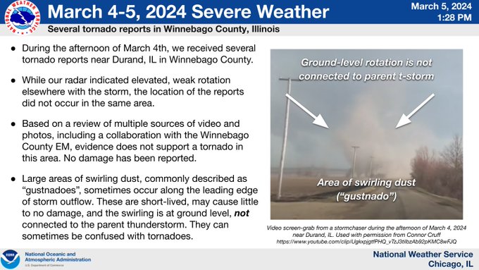
Alas, that was not a true tornado, according to the National Weather Service. That was something called a GUSTnado, which is a new term for me!
So, what’s the difference? Well, for it to be a true tornado, the swirling wind has to be connected to the storm clouds above. Otherwise it’s just…well…swirling wind, which when picking up the amount of dust in the video above, looks rather dramatic! Don’t let it fool you though, gustnadoes can have winds similar to an EF-0 or EF-1 tornado, so they can be dangerous when tossing around debris.
The NWS says there was weak rotation in the area, but NOT where this gustnado was seen. There was a Severe Thunderstorm Warning in place in the gustnado area near Durand, Ill. (with winds over 60 mph), but there was no actual tornado.
The NWS did a great break down about what happened on Monday night
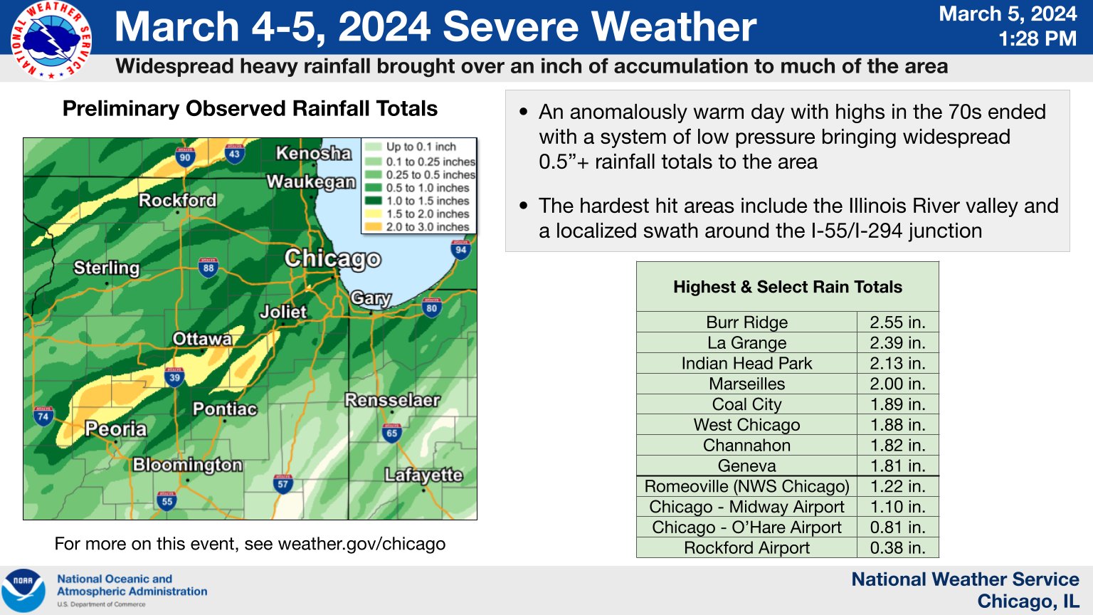
What most of us DID see was a light show and some TERRENTIAL rain! Take a look at some of these numbers for Romeoville, Burr Ridge, West Chicago, Geneva and other towns: